 Why We Need Maps and Kiosks
Creating consistent trailhead and digital maps for the six public trail systems in our area is necessary to make our diverse, multi-use trails more welcoming and safer for new riders, more enjoyable for our existing riders, and help visitors find and navigate our local trails. We currently lack those assets for several systems.
VMB maintains more than 60 miles of singletrack in our region, and six unique trail systems that offer everything from old-school tech to new school jump trails. We have beginner friendly lakeside trails, and an amazing urban trail system only three miles from downtown Allentown, Pennsylvania’s third largest city. All trails are within a 20 mile radius of our downtown core and in a region that has more than a million residents.
While we have a wealth of trails, we lack clear, cohesive signage, welcoming trailhead kiosks, and easy to follow maps. In 2022, we completed the first step of this project, installing directional signs at each system. This effort represents the next critical step: producing clear, consistent, easy to follow physical and digital maps for each trail system and installing trailhead kiosks to display those maps and other important information–welcoming riders to the trails and providing the information they need to have a safe, fun, enjoyable experience.
With proper signage, helpful maps, and welcoming trailheads, we expect to see even more users of our trails, leading to healthier communities, more volunteers to assist with stewardship, and an economic boost to our region from additional recreation-based tourism.
What About These Maps?
We are working with Patrick from Offthemaps, a local rider (now living in Europe) who has created maps for the D&L, City of Easton, and other local groups. The goal is to produce accurate, engaging helpful maps that we can display in the new kiosks, share digitally, and that are compatible with trail apps. Each map will show the trail system in detail, including important points of interest, helpful information, and details and background that help new and existing riders have a better, safe, more enjoyable experience. We expect the maps to be ready in September 2026.
And the Kiosks?
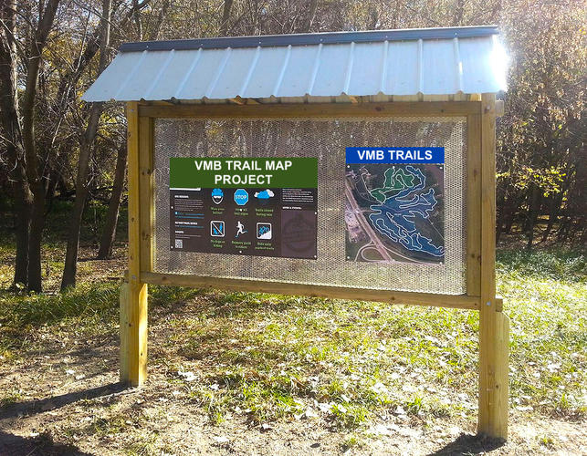
We are working with land managers to identify the correct size and design of kiosks to fit their requirements. We expect each one to contain the VMB trail map, other essential info for riders, QR codes for digital versions of the maps and trail info (for on the trail navigation) and other relevant details. We’ll construct the kiosks using volunteers (if you’re a contractor or know of anyone who’s good with building things with wood who can help, let us know!). We think we’ll need at least 6 new kiosks, and will aim to have them installed by spring 2027.
When We’re Finished:
When completed, we’ll have installed more than 200 signposts across the valley, multiple kiosks and for the first time ever have clear, accurate, consistent maps for all our trail systems. We want to build an incredible mountain bike community–one that supports our members and long-time locals as well as welcomes new riders from nearby or who are visiting from out of town. This project will make that so much easier.